
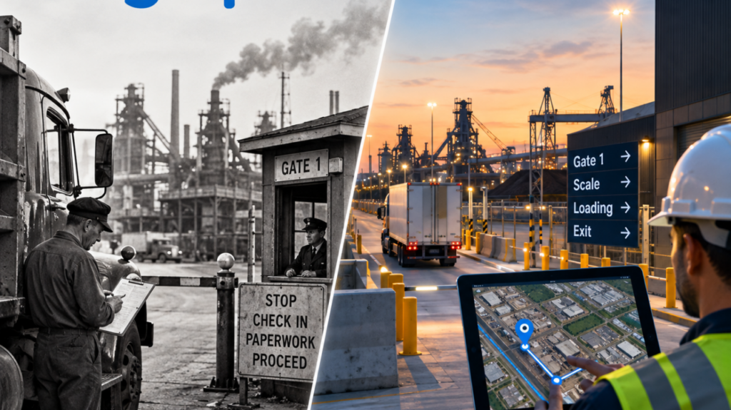
Walk into almost any modern industrial operation and the technology is impressive: Automated equipment. Sophisticated ERP systems. Advanced transportation platforms. Sensors. Telematics. AI. Predictive analytics. Even robots.
And then a truck arrives at the gate. Suddenly, it can feel a little like 1950. The driver stops. Someone needs paperwork. Someone else needs to know where the load is going. Directions are given verbally, by radio, on a printed map or through a phone call. A dispatcher may know the truck arrived, but not what is happening inside the facility. Operations knows there is congestion somewhere, but not necessarily why. A customer is waiting for an update, so someone starts making calls – on a CB radio.
The technology exists. The operational visibility often doesn’t.
Knowing Location Is Not the Same as Understanding Movement
For years, location technology has largely answered one question: Where is it? That was valuable. It still is But in complex supply chain and industrial environments, it is increasingly the beginning of the question, not the answer.
Knowing that a truck is at, say, a steel mill or port, doesn’t tell you whether it is at the correct gate. Knowing that a vehicle is inside a port doesn’t tell you whether it has reached the right terminal, is sitting in congestion or has been waiting 47 minutes for its next move. Knowing that equipment is somewhere within a mining operation doesn’t necessarily tell you what is happening operationally around it.
The dot is data. The movement around that dot is intelligence. And that distinction matters.
The Physical World Has Become a Data Problem
Steel mills, mines, ports, distribution centers, manufacturing facilities and large industrial yards are extraordinarily complicated environments. They were not designed like city streets. Public GPS can get someone to the property address. From there, the operational journey may have just begun.
Which entrance? Which gate? Which scale? Which loading area? Which internal road? Which areas are restricted? Where is congestion forming? How long has the vehicle been sitting there? And what should happen next?
Too often, those answers still live in the heads of experienced employees, on paper maps, over CB radios, in phone calls or through institutional knowledge passed from one person to another. That worked when supply chains moved differently.
Today, the cost of not knowing compounds quickly. A few minutes at a gate becomes dwell time. Dwell becomes congestion. Congestion affects throughput. Poor directions become a safety issue. A lack of visibility creates phone calls. And dozens of small inefficiencies across hundreds or thousands of movements become a very real operational cost.
This Isn’t Really a Technology Problem
This may be the most interesting part. Many organizations already have enormous amounts of technology. The harder challenge is changing how we think about location. A map is not simply something that shows where a vehicle is. It can become an operational layer.
Location can tell us that something arrived, entered a geofence, stopped unexpectedly, took the wrong route, remained somewhere too long or reached the next stage of a journey. Combine location with operational context and suddenly we can begin asking much better questions: Where is the friction? Where are we losing time? Where is congestion developing? Where are drivers getting confused? Where are safety risks being introduced? What can we change because we can finally see it?
That is a very different conversation from tracking a dot, right?
Some Industries Are Still Making This Leap
Supply chain, logistics and heavy industry are filled with extraordinarily sophisticated people solving extraordinarily difficult problems. But some operating practices have survived for decades simply because that is how the work has always been done. That is understandable. Industrial environments cannot chase every new technology trend. Reliability matters. Safety matters. Systems need to work in the real world, not just in a software demo.
But there is also a cost to assuming that a process should remain unchanged simply because it has worked for 30, 50 or even 70 years.
The question shouldn’t be:“Why change what works?” A better question is: “What could work better if we could finally see what is actually happening?”
The Next Evolution of Location
I believe the future of location technology is much less about watching dots move across maps. It is about understanding what those movements mean. For supply chains, that could mean identifying dwell before it becomes a larger bottleneck. For industrial facilities, it could mean safely guiding unfamiliar drivers through complicated private environments. For ports, it could mean creating a shared view of movement across sprawling operations. For customers, it could mean proactive visibility instead of another “Where are you?” phone call. And for operators, it means turning thousands of individual movements into information they can actually use.
The little blue dot was an important beginning. But after decades of GPS innovation, perhaps it is time we started asking more of it. Not just: Where are you? But: What is happening and what should we do about it?